
Drilling to date
Collars from the Ontario drill-hole database and the 2022 log. 84-8 and 84-9 are on the Highway 11 grid, about 2 km south of the claims, off this map. See the holes in 3D in the Property Viewer.
| Holes | Year | What they found |
|---|---|---|
| 84-1 to 84-7 (84-6 collared three times as 6A–6C) | 1984 | Nine short holes, 7–36 m long, 616–776 m south of the Reed showing (J. D. Reed; public assessment files 42A01SE0131 and 0196). No assays survive in our records. |
| 84-8 and 84-9 | 1984 | 35 m and 31 m, on the Highway 11 grid (42A01SE0197). |
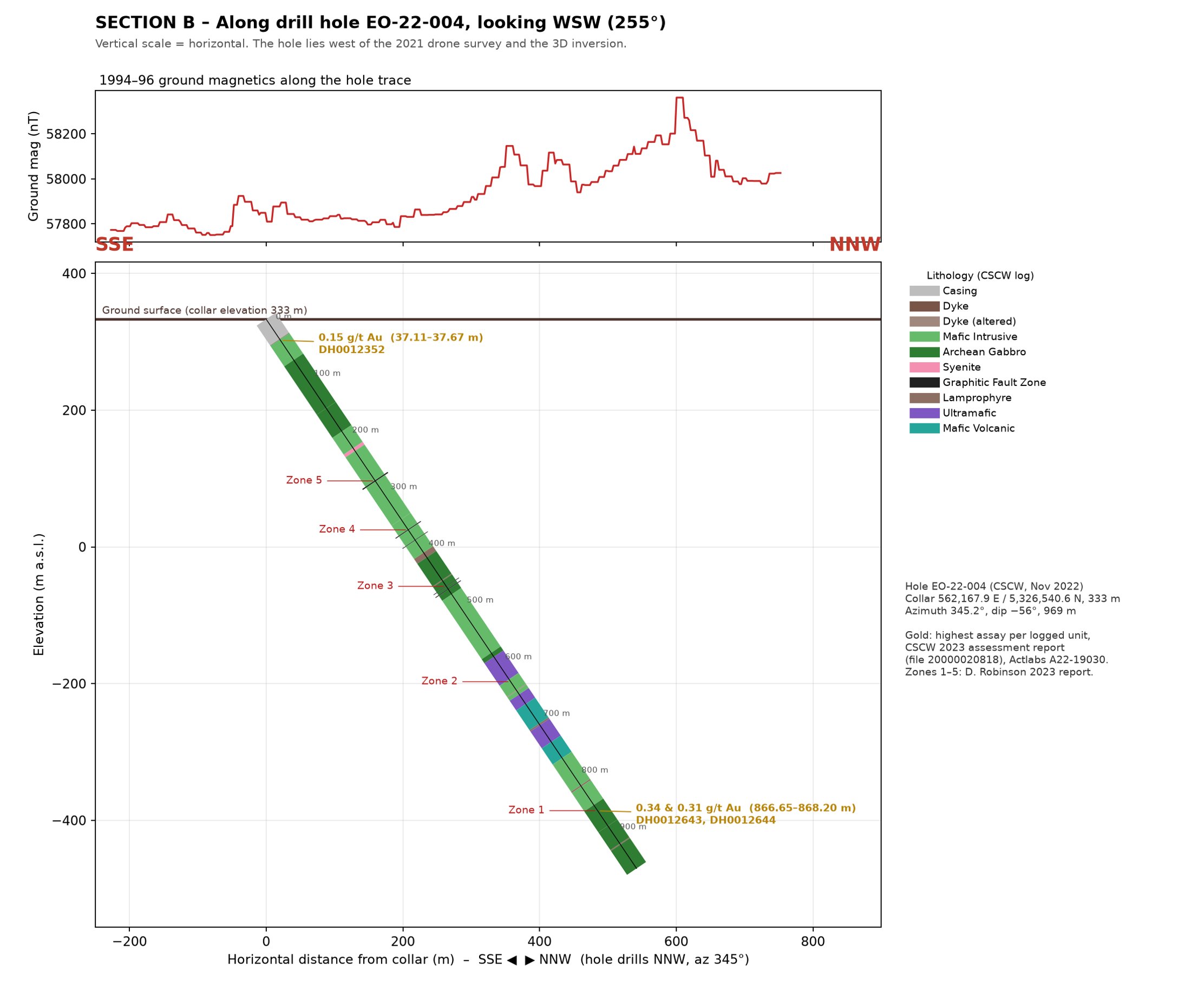
| EO-22-004 | 2022 | 969 m at −56°, aimed at the Cadillac–Larder Lake deformation zone, collared about 1.8 km west of the Reed showing (Canada Silver Cobalt Works; 20000020818). Mostly mafic intrusive rock and gabbro. Best gold: 0.34 g Au/mT over 0.55 m from 866.65 m (0.32 g Au/mT over 1.55 m with the next sample). |
Surface rock, channel and soil results are on the Showings page.
Key observations
Where to drill next: two ways of picking
Doug Robinson picked his holes from his field work on these claims since 1994. Our AI model picks spots from the same data by scoring it against his gold signs. Where the two agree, confidence goes up.
Picked by Doug Robinson
Proposed by Doug Robinson, P.Eng., in his filed 2023 assessment report (20000021754), each aimed across a mapped structure – the Reed showing, the IP targets, the deformation zones and the MMI soil anomalies.
See Doug Robinson’s picks ›Picked by our AI model NEW
Every spot on the old grid lines is scored out of 100 against 23 gold signs that Doug Robinson set. A spot that scores 30 or more is a target. Each score lists its reasons.
See the AI picks and how it works ›Neither is a result. Only drilling tests a target, and every hole needs a Qualified Person’s review before it is drilled.