
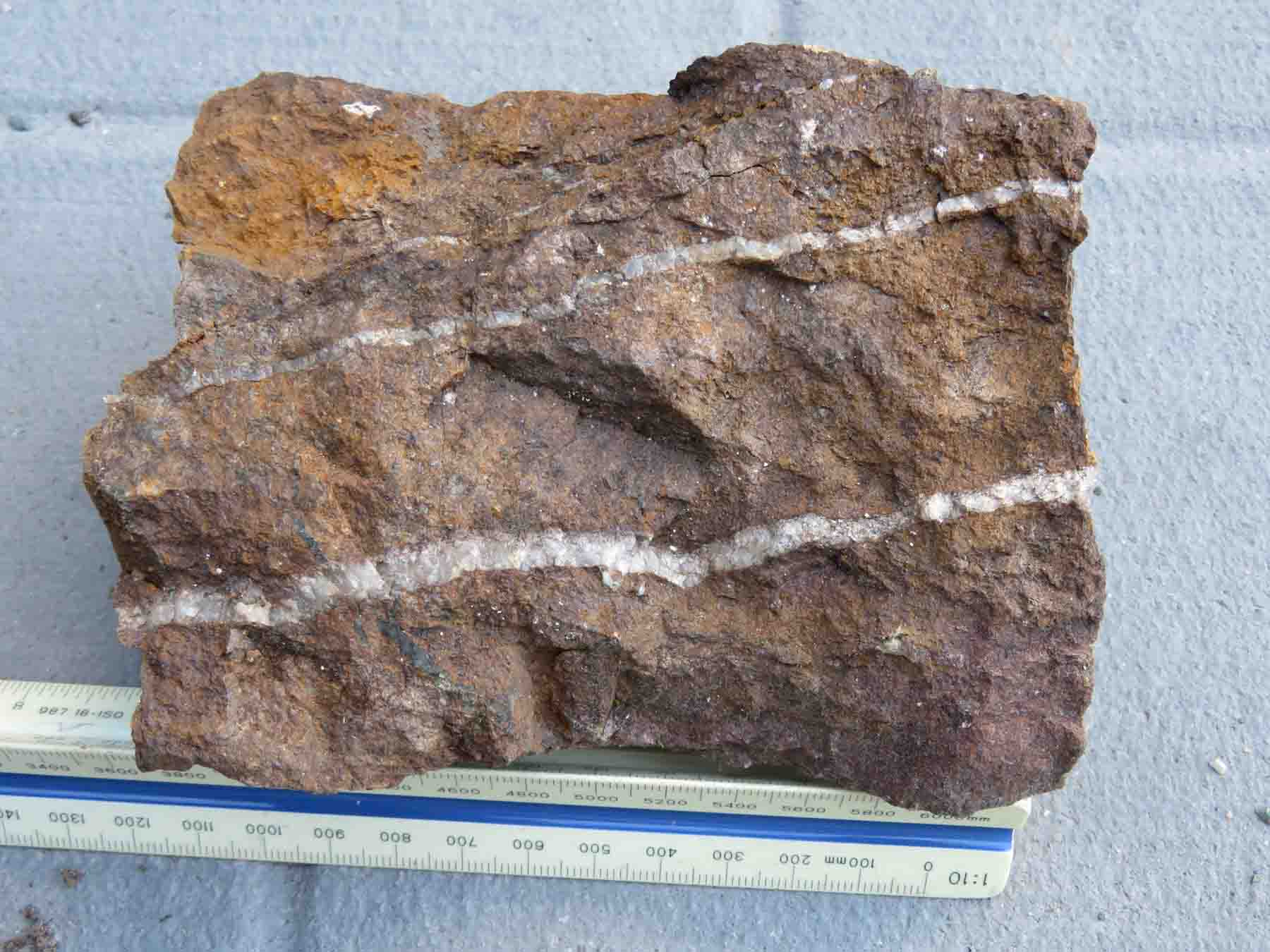
A historic grab sample of outcrop at the Boudreau showing reportedly assayed 1 oz Au/ton, about 34 g Au/mT (Doug Robinson, P.Eng., 2023 filed report, AFRI 20000021754). The outcrop was hand stripped in 2021.
Location
The Boudreau showing is in the west of the property, about 750 m west of the R vein, in the Kirkland Lake gold camp of north-eastern Ontario.
| UTM (NAD83, zone 17N) | 561514 E, 5327134 N |
|---|---|
| Latitude / longitude | 48.0945° N, 80.1739° W |
| Elevation | 333 m above sea level |
| Townships | Eby / Otto, Larder Lake Mining Division |
| Surveyed | GNSS survey by Surveyors on Site, May 2022 (zero reference point, about ±0.5 m) |
Geology
The vein strikes east–west and is near vertical (Doug Robinson, 2026). The sample photographed below is rusty rock cut by white quartz veinlets.
The 1 oz Au/ton result is a single old grab sample with no sample number, so on our Top 5 gold showings list it ranks second, behind the Reed showing with its repeated cut samples.
Sampling
The historic 1 oz Au/ton grab sample has no sample number or lab certificate on the site; the table below lists samples nearby.
Every sample recorded within about 25 m of the showing, from the site’s database:
| Year | Sample | Type | Width | Gold | Description | Report |
|---|---|---|---|---|---|---|
| Loading the samples… | ||||||
Grab samples are selected pieces of rock and are not representative; channel samples are cut across the vein or zone. The Reed showing’s cut samples and laboratory certificates are on the Reed showing page.
Photos
Click a photo to enlarge it. More photos are on the map’s Photos layer.
Geophysics
The property’s ground, IP and Aerial drone magnetic surveys are described on the geophysics page.
Drilling
We have no record of a drill hole at the Boudreau showing. Doug Robinson’s 2023 filed report says the showing points to the Cadillac–Larder Lake deformation zone being close by, and that it may have influenced where hole EO-22-004 was drilled, about 490 m west of the hole’s deep intersection.
| Hole | Year | Company | Length | Distance | Report |
|---|---|---|---|---|---|
| Loading the holes… | |||||
The nearest recorded drilled holes; distances are from the showing to the hole’s collar. All holes: the drilling page.
History
- c. 2000 – A grab sample of outcrop reportedly assayed 1 oz Au/ton. AFRI 20000021754
- 2021 – The outcrop hand stripped. AFRI 20000021754
- 2022 – The vein’s zero reference point surveyed by GNSS (Surveyors on Site).
Reports
Assessment reports filed with the Ontario ministry that cover the showing:
- Deposit-alteration modelling, 2021 fieldwork, Reed Robinson property (Doug Robinson) AFRI 20000021754 · 2021–23 · Stripping, mapping, channel sampling, magnetic susceptibility
- Diamond drilling report, Reed-Robinson claim group (hole EO-22-004) AFRI 20000020818 · 2022 · Diamond drilling
Documents
Signed-in investors also get the library copies of these reports, the survey maps and the data room.
Other showings: Reed Showing · Reed Trench · G Vein · S Vein · R Vein · all showings