
Before the Eby–Otto property took its present shape, its owners explored a much larger area along the Larder Lake–Cadillac break west and east of it. That ground has since lapsed and is not part of the Eby–Otto property; much of Eby West is now held by Stardust Metal Corp. The work, though, is on public file with the Ontario Geological Survey, and it shows how the trend continues.

Eby West (Kenogami Lake area), 1995–1999
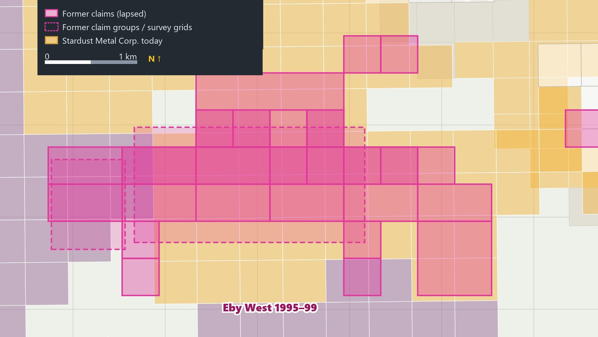
Doug Robinson held 22 claims (36 units) in Eby Township west of the present property, mostly in the north half of Concession IV, lots 6 to 11. The program, partly funded by the Ontario Prospectors Assistance Program, included:
- 1995: 24 km of cut grid at 100 m spacing (lines 1400W–3900W), 23.9 km of ground magnetics, 16 km of MaxMin electromagnetics and 1:1000 geological mapping, with stripping
- 1996: a further 7.3 km of grid at 50 m spacing, with magnetics and MaxMin
- 1997–99: Phase 2 to the west (lines 4000W–4800W): 10.8 km of grid, walking magnetometer, MaxMin and mapping
The MaxMin survey outlined bedrock conductors, and the reports recommended drill holes on them. The claims lapsed around 1999, before the recommended holes could be drilled. Most of the Eby West ground now lies within Stardust Metal’s Kirkland West project.
In 2010–11 Betty and Doug Robinson returned to run MMI soil geochemistry lines across the north of Eby West (assessment file 20000006350).
Highway 11 grid, 1994–1996
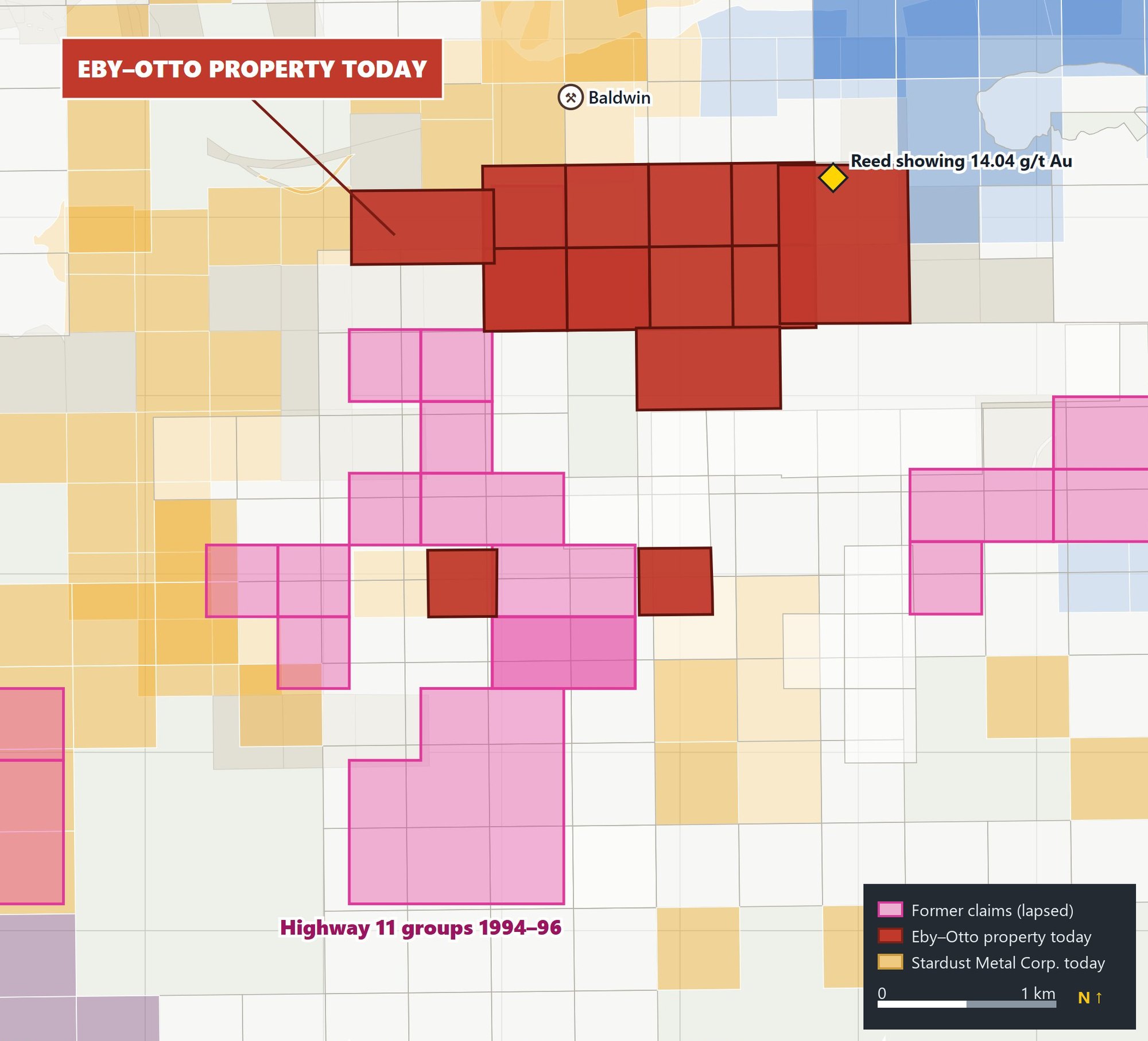
South of the present property, along Highway 11, the Eby SE and SW claim groups were cut, mapped and surveyed with magnetics and MaxMin in 1994–96 (about 9 km of grid at 50 m spacing), with Fe-carbonate and quartz-stockwork zones mapped and sampled.
Otto Horne-Robinson (Otto South), 1996–1997
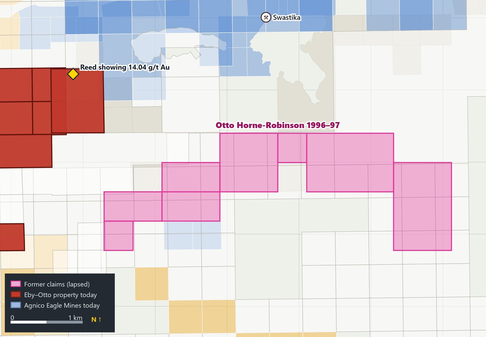
East of the property, in Otto Township Lot 11, Concession V, Doug Robinson and J. Horne held nine claims (25 units). They cut about 10 km of grid (lines 4785E–5600E), ran 10 km of walking magnetometer and 5.6 km of MaxMin, and mapped and sampled the ground. A sulphide conductor with a gossan was traced over about 200 m, and the best gold value was 267 ppb. The ground is now held by others.
Public assessment files
| File | Years | Area | Work |
|---|---|---|---|
| 42A01SE0090 | 1995–97 | Eby West | Grid, magnetics, MaxMin, geology |
| 42A01SE2003 | 1995–97 | Eby West Phase 1 | Grid, magnetics, MaxMin |
| 42A01SE2008 | 1997–99 | Eby West Phase 2 | Grid, walkmag, MaxMin, geology |
| 20000006350 | 2010–11 | Eby West | MMI soil geochemistry |
| 42A01SE2002 | 1996–97 | Otto Horne-Robinson | Grid, walkmag, MaxMin, geology, assays |
| 42A01SE0085 | 1994–96 | Highway 11 grid | Grid, magnetics, MaxMin, mapping, sampling |
These reports can be read through the Ontario Geological Survey’s GeologyOntario service by file number. A compiled package of this work – grids, magnetics, MaxMin and MMI, georeferenced – is part of the data offered to an investor and is in the data room.